Some time ago I returned from a four-day trip to the Chernobyl exclusion zone. It just so happened that I didn’t want to pay a lot of money for the opportunity to sit on a bus with a boring guide and tourists who are taken along the usual route, but to get to Pripyat on my own.
The exclusion zone of the Chernobyl nuclear power plant is a territory prohibited for free access, subject to intense contamination by long-lived radionuclides as a result of the accident at the Chernobyl nuclear power plant.
The Chernobyl zone includes the north of the Ivankovsky district of the Kiev region, where the power plant itself, the cities of Chernobyl and Pripyat are located, the north of the Polessky district of the Kiev region (including the village of Polesskoe and the village of Vilcha), as well as part of the Zhytomyr region up to the border with Belarus.
A border settlement that is relatively convenient for illegal entry into the ChEZ is the village of “Gubin” not far from Dityatki. The perimeter is a control strip about 15 meters wide with one row of barbed wire. Thus, it is not particularly difficult for an outsider to enter the Zone. (in fact, the wire is not to keep people out, but to prevent anything from escaping from there!).
Having gone deeper into the forest, I walked quite briskly through a thick carpet of needles and moss. Later it will become clear that the best strategy is to follow the clearings, but for now we had to break through. At the same time, the compass was a little cloudy and the trajectory was not the most direct. From time to time we encountered monster trees. The average background was 30–40 microroentgen/hour. The closer we got to the center of the zone, the more crippled trees like this appeared. I'm not sure there is any direct connection here.
As in any forest, a wild number of mosquitoes and midges awaited us in the zone. In addition, we met a large number of wild animals and their traces (paw prints or piles of droppings, for example). The absence of people allowed the animals to breed well, so one of the main dangers facing an illegal tourist is encountering wild animals.
Most forests are artificial, planted in even rows, separated by clearings. The clearings are fresh in some places, littered with debris and branches in others. The places are amazingly beautiful.
The first settlement is Yampol. 25 years since the Chernobyl accident have done their job - now this place is inhabited by different owners. Houses, sidewalks, lampposts, entire streets - everything is in the power of plants. Methodically and slowly, nature turned the achievements of civilization into smithereens. According to some information, a self-settler settled in the village long ago - an old man with dogs. However, walking along the outskirts of the village, we did not encounter any signs of life, with the exception of several long-standing “stalker” sites, and we didn’t really want to get acquainted with a feral person. You can still live in many houses...
Many houses have a real stove inside, and in some places the lining and some of the interior have even been preserved. In a forest nearby we stopped for the first night, pitching a tent in the thicket of the forest. The dosimeter readings show slight deviations from the norm. Therefore, you can allow yourself to rest a little and take photographs in the village - and then hit the road. The only thing that kept me from relaxing was the heavy traffic of cars on the road.
The first serious obstacle is the bridge over the Uzh River. Just 100 meters of straight road with excellent visibility, extremely heavy traffic and zero chance of jumping into the bushes. After a short respite, the bridge was crossed.
By the way, there are actually two bridges, they are just parallel. One is older, with the remains of spotlights on the sides, the second is newer. And the water in the Uzh River is amazingly clean. The bottom is soft, pleasant sand. The background radiation is only 51 microroentgens/h, so you just want to take a swim. A place of wondrous beauty.
Having crossed the bridge, the group approached the village of Cherevach. Next to it there is a fire tower, which at first I wanted to climb to conduct reconnaissance on the ground, but suddenly it turned out to be inhabited and everyone had to hide behind an abandoned village house, entwined grapevines. The grapes produced only 37 µR/h, so I sharpened a sprig of ripe fruit. Chernobyl grapes - yum-yum!
After passing Cherevach, we came to the village of Zapolye, where we stopped for lunch. The stew, heated on the burner, was pleasantly brightened by local apples with a relatively low background.
Immediately after the village there is a local cemetery. Many crosses look very fresh, although they have not been restored since the Chernobyl accident.
On the road from the cemetery, on the side of the road, a severed head of a doll hangs on a tree branch. It is unclear who did this and why, but it looks very creepy.
Far away in the field is a herd of Przewalski's horses. In the early 1990s, several horses were released as an experiment into the Ukrainian exclusion zone of the Chernobyl nuclear power plant, where they began to actively reproduce. Now there are about a hundred of them there, three herds. They are absolutely free, they can be safely called truly wild horses. No genetic abnormalities or other mutations were recorded. They say that before they were not at all afraid of people, but this was prevented by poachers who loved to shoot gullible horses.
Looking ahead, I will say that in the Zone I saw everything: two herds of horses, a fox, wolf and bear tracks and droppings, squirrels, snakes (two of them), a herd of wild boars and a hare. In addition, the forest was full of elk, deer, and a couple of bloodsuckers, but they were sucked into the anomaly.
Towards evening we went out onto the concrete road, which led to the main goal of our journey. There it is, looming on the horizon. Here, not far from the road, we camped for the second night, pitched a tent, had dinner and went to bed.
In the morning it immediately became clear that we had made the right choice of place. A yellow shield with peeling paint warned that something mega-interesting was located further down.
And so it happened. The main goal of our trip is the Duga over-the-horizon radar.
25 years ago it was a top secret facility - a pearl of space reconnaissance and a military dream, which made it possible to monitor the movement of all types of above-ground targets not only over Europe, but also provided the opportunity to “see” missile launches of a potential enemy on the North American continent. With the help of the most powerful and ultra-modern (at that time) radars, the military was able, in the literal sense of the word, to look beyond the horizon. Obviously, thanks to such abilities, this complex received the name - over-the-horizon radar stations (ZGRLS) or “Duga-1” (Chernobyl-2 Long-Range Communications Radio Center). The unique capabilities of the radar were hidden in the innovative ideas of the designers, which were embodied in masts and receiving antennas of gigantic dimensions. It is difficult to talk about the exact geometric dimensions of the ZGRLS. Publicly available data is inconsistent and likely inaccurate.
The cost of investment was seven billion Soviet rubles. For comparison, this is twice as expensive as the construction of the Chernobyl nuclear power plant. Obviously, the construction of the ZGRLS near the nuclear power plant was explained by the large energy consumption of the facility. According to available information, the ZGRLS consumed about 10 megawatts.
Along the line of antennas there is a technical building where the receiving equipment was once located. About 300 meters in length.
We climb out the window and get even closer to the antennas!
They are huge and simply amazing. A place absolutely wild in terms of energy stands under the scorching heat in complete silence. Once upon a time, for the characteristic sound on air made during operation (knock), the station was named Russian Woodpecker.
It sounds like this:
The radar operated in the frequency range 5–28 MHz. The antennas are built on the principle of a phased array antenna. Since one antenna could not cover such a wide frequency band, the entire range was divided into two sub-bands and two antenna arrays were also installed. Thus, the height of the low-frequency antenna masts is from 135 to 150 meters, and the length is from 300 to 500 meters. The high-frequency antenna is somewhat more modest. About 250 meters in length and up to 100 meters in height. With such an amazing size, the object is visible from almost anywhere in the Chernobyl exclusion zone.
The ZGRLS in the city of Chernobyl-2 was intended only for signal reception. The transmitting center was located near the city of Lyubech, Chernigov region, which is 60 km from Chernobyl-2. The transmitting antennas were also built on the principle of a phased array antenna and were smaller and lower, its height was 85 meters. This radar has now been destroyed. The picture shows a diagonal view of the receiving antenna.
Having looked at the radar, we climb out of the perimeter of Chernobyl-2 and go through clearings to Pripyat. After a few hours we reach the top of a hill with a wonderful and exciting view.
Here the planted pine forest periodically intersects with such wastelands. Background - 250–300 µR/h.
Having crossed the field, we go deeper into the forest. The legs are already buried in the moss, sagging by 10 centimeters under the weight of the body. The moss here is also radioactive and is a good signal for “spots” with an increased background. In general, in the forest the background is 2–2.5 times higher than in wastelands.
Both in the forest and in the fields there are remains of canals for reclamation. A narrow strip of water 4 meters wide is in fact a difficult obstacle to overcome. There is no desire to wade through muddy, foggy water. We searched for a suitable crossing for about an hour and finally found a successfully fallen tree.
After the usual forest, we enter Ryzhiy, or rather the place where it once was. The Red Forest is about 10 km² of trees adjacent to the Chernobyl nuclear power plant, which took on the largest share of the release of radioactive dust during the reactor explosion in 1986. The high dose of absorbed radiation led to the death of trees (mainly pine trees) and their coloring brown-red. In addition, a glow was observed at night dead trees(this was caused by the interaction of tree enzymes with radioactive particles), also caused radioactive decay. During work to decontaminate the area, the forest was bulldozed and buried.
Now in the place of the Red Forest there is a wasteland with sand, planted with young spruce trees and a very strange, fenced area with a booth and a radio mast. At first the thought arose that these were the buried remains of a red forest, but they are located 400 meters to the west. Here the background really jumps, rising to 2200 µR/h right at the fence. This is 110 times higher than normal.
Perhaps there is something else lying here. The confusing thing is that the signs, fence and booth are completely new.
We quickly pass this bad place and go deeper into the forest again. We are already close to Pripyat - we are met by this worker with a poster.
Along the way, houses and dilapidated hangars begin to appear.
Here and there there are mounds with burials and warning signs stuck into them.
We pass the "Bridge of Death". One of the legends of the Zone is that the radiation level on this bridge on April 26, 1986 reached 500-600 roentgens per hour, i.e. One hour spent on this bridge could cost your life. But then people didn’t know anything; many, including children, went to the bridge to see what was happening at the station. Police posts were posted on both sides of the bridge. A radioactive cloud passed over the southern part of the bridge. Of the policemen on duty that day, none survived.
Overpass to Yanov station. Before the Chernobyl accident, the station belonged to the South-Western railway. Passenger and cargo work was carried out at the station, adjacent to the access roads of the Chernobyl Nuclear Power Plant, ORS warehouses, oil depots and other enterprises of the city of Pripyat. Currently, one of the tracks passing through the station has been reconstructed and is used to support construction work on the construction of the Shelter-2 facility - a new sarcophagus for the Chernobyl nuclear power plant.
We enter Pripyat. Currently, there is a lot of radioactive dust in the city, which fell from the destroyed power unit and consists of relatively long-lived radioactive elements. This dust collects in ditches and depressions. The dust has become firmly embedded in the soil, trees, and houses. The city is overgrown with Chernobyl grass, which grew in the surrounding area before the accident.
Announcement of evacuation from Pripyat.
We go up to the roof of the nine-story building closest to the station to look around. From here you have a magnificent view of the Chernobyl Nuclear Power Plant.
Chernobyl sunset and the profile of the Jupiter plant against its background.
From the roof we notice a tall sixteen-story building in the city center and decide to move to it. There is some traffic along the central streets, a bus is driving, so you have to make your way through courtyards and alleys. Everything is very overgrown. In fact, there is little left of the city and Pripyat is just houses in the forest.
Here is our sixteen-story building. This is where we'll spend the night.
The front entrance is surrounded by greenery, but it is still not difficult to find. There is a lot of garbage everywhere, as the looters and iron workers did a good job after the accident - apartments were looted, metal was cut down.
We go up to the roof of the building to spend the night. It’s safe here, the Soviet coat of arms, a gorgeous view of the Chernobyl nuclear power plant and the background is only 40 microns per hour. Having risen, we hear an animal roar and chomping sounds at the foot of the building. Leaning over the edge of the roof, we see a herd of wild boars eating some roots and prowling the lawns. Thank God they can’t get up here, so we cook our last dinner in the Zone and go to bed.
As a person who visited the Zone illegally, I categorically do not recommend repeating this. This is a truly grueling journey with a serious risk of picking up radiation or being eaten by wild animals, and the wild boars I saw are further proof of this.
What is the exclusion zone of the Chernobyl nuclear power plant? This is an area that has been closed to public access since 1986. The forbidden zone includes the northern part of one of the districts of the Kyiv region. A power plant was once located here, where the worst accident of the 20th century occurred. More details about the disaster, its consequences and the rules for visiting the 30-kilometer zone are described in this article.
Accident
It is impossible to talk about what the exclusion zone is without providing a chronology of the events that occurred on April 26, 1986. On this day, an explosion occurred in the fourth power unit, destroying the reactor. The building collapsed. At the time of the explosion, 2 people died - employees of the power plant. The body of one of them was never found.
On that day, employees were supposed to shut down the fourth power unit. This was required for the next scheduled repair. During such events, specialists usually test the equipment. This time it was necessary to check the “Turbogenerator rotor run-down” mode. This was the fourth test of this type.
The experiment began at 01:23. At the first stage of testing, the power behavior did not cause any concern. The emergency protection signal was detected forty seconds after the start of the experiment. According to various accounts, several powerful blows occurred at that moment.

Causes of the accident
There are two official versions. State Commission responsibility was placed on the personnel and management of the power plant. During the investigation, it was discovered that the accident was the result of gross violations of operating rules. In particular, employees should not have carried out the experiment at any cost - a change in the state of the reactor was observed that day. There is another version, voiced later, in the early nineties: the cause of the accident was the unsatisfactory state of the reactor design.
What is an exclusion zone? This is a territory with a special status. City or several settlements, in which there are no conditions for normal living. The evacuation of residents from Pripyat began only on April 28. That is, it was possible to assess the scale of pollution only after 2 days. However, even when it was made, Soviet television, unlike Western media, broadcast programs dedicated to the May Day demonstration.
First, residents of a ten-kilometer zone were evacuated. In the following days, settlements located near Pripyat were deserted. An exclusion zone has formed. Chernobyl is now associated throughout the world with an accident that killed thousands human lives. Moreover, among those killed in the disaster were not only nuclear power plant employees and firefighters. People exposed to radiation died gradually, sometimes after a few days, sometimes after years. The number of victims of the Chernobyl disaster is several times greater than the bombing of Hiroshima.

Exclusion zone (Chernobyl)
So, the prohibited territory was determined shortly after the disaster. It is divided into 3 parts. The first is a special zone. There is a dilapidated power plant building here. The second territory is a 10-kilometer zone. The third is 30 km long.
The population was evacuated. The workers who maintain the power plant remain. Radiation monitoring has been organized for them, decontamination points have been installed - a disinfection method. At the borders, employees change from one vehicle to another. This reduces the risk of transferring radioactive substances.
In the nineties, a gradual resettlement of residents from territories located outside the thirty-kilometer zone began. The populated areas of the Polesie region were deserted. What is the Exclusion Zone? This is territory where it is dangerous to be. It included the settlements of the Polesie region. Now the villages of Vilcha, Dibrova, New world became part of the exclusion zone. The radiation level when entering the thirty-kilometer zone is 12 microroentgens/hour. The risk of radiation exposure today is certainly not as high as it was 30 years ago.
Thrill-seekers have been increasingly seeking to get into the ghost town, the territory of which is terrifying even in photographs. What attracts them to the “dead zone”?

Objects of the Chernobyl exclusion zone
Within the contaminated territory, work is being carried out to prevent the spread of radioactive substances beyond its borders and their entry into water bodies of Ukraine. The center of the “dead zone” is Chernobyl. It, like Pripyat, is called a ghost town. There is an Administration on the territory, which is a department of the Ministry of Emergency Situations. The personnel of the ATO enterprise are also located here. Who lives in the exclusion zone? The so-called self-settlers. This term originated in the eighties.

Residents of the "dead zone"
In 1986, a complete evacuation of the population was carried out. Ukrainian legislation today provides for limited residence in the exclusion zone. Despite this, some returned to their native places. In 1986, approximately 1,200 people lived here. For comparison: after the disaster, about one hundred thousand residents were evacuated. According to 2007 data, the population in the exclusion zone is just over three hundred people. Among them, elderly people predominate. The average age of self-settlers is 63 years.
How is the life of the inhabitants of these godforsaken places? The main source of livelihood for them is homestead farming. Sometimes employees of enterprises in the Chernobyl exclusion zone help. For example, they repair buildings and conduct medical examinations. From time to time, residents of the “dead zone” receive humanitarian aid. One of the reasons for returning to their native places is poor quality housing provided by the state. Often several families from Pripyat and Chernobyl lived in one apartment.

Nature reserves
Chernobyl landscapes look absolutely dead. It seems that every living thing is dying here. Oddly enough, several objects of the country’s natural reserve fund are located on the territory of the zone. These deserted places are gradually turning into a reserve for rare animals. Bear, badger, otter, muskrat, deer, and lynx live here. There are huge numbers of wolves, moose, roe deer, hares, foxes and wild boars. The body of a wild animal is capable of coping with increased background and chemical pollution on its own, says one of the employees of the Center for Nuclear Safety.

Tourism
The “Dead Zone” has long become a center of prohibited tourism. In the nineties, a set of measures was taken to eliminate the consequences of the accident. After this, the radiation level decreased significantly not only in the surrounding areas, but also in the area of the power plant. Since then, the exclusion zone has been very popular among tourists. There are both legal and illegal excursions.
There were quite a few looters here in the late eighties. The first tourists appeared after the radiation level dropped. In the mid-90s, the state enterprise Chernobylininterinform was created. One of his tasks is organizing trips to the exclusion zone. Subsequently, many small firms appeared that also provided assistance in resolving such issues. Agencies that carried out legal activities collaborated with the Chernobylinterinform enterprise.
According to a UN report, since 2002, most places in the Chernobyl zone can be visited without much harm to health. The annual number of tourists visiting the vicinity of the former power plant is growing. True, in 2011 access was closed again, although not for long. In 2013, Chernobylinterinform was liquidated. Today, the Chernobyl Special Plant organizes trips.
Visiting rules
There is a checkpoint regime on the territory of the zone. All visitors must have documents with them. Traveling independently is strictly prohibited, only accompanied by a guide. Photography is permitted but limited. It is not recommended to eat, smoke, touch plants and structures, or sit on the ground on the territory. It is prohibited to take any items outside the zone.
Illegal entry is a criminal offense. However, nothing stops the stalkers. They still continue to penetrate the territory of the exclusion zone. Law enforcement agencies detain here every day on average 5-6 stalkers, among whom, as a rule, are residents of nearby settlements.
From Kyiv to the Chernobyl Exclusion Zone (ChEZ), most of which is located in the Kyiv region, you can get there by car in one and a half to two hours. There are several villages and villages in this area, and closer to the zone there is only forest. At the Dityatki checkpoint, visitors are greeted by police officers, three red cats and a red dog. There is a kind of border here - a fence with barbed wire extends from the checkpoint deep into the field. The police check passport data with lists sent in advance, before the trip. Only local workers, relatives of self-settlers or tourists strictly with accompanying persons can enter the zone legally. In 2009, according to Forbes magazine, this place was included in the list of the 12 most exotic tourist destinations along with Antarctica and North Korea. The radiation level in some places exceeds the permissible level by 30 times, but this does not stop those who want to look at the largest monument to the man-made disaster. Over the past ten years, 40 thousand tourists have visited the ChEZ. The flow has grown significantly since the release of the popular computer game“S.T.A.L.K.E.R.: Shadow of Chernobyl”, which takes place in the territories adjacent to the Chernobyl nuclear power plant. Since then, they began to enter here illegally more often: every year about 400 stalkers are detained, who are punished with a fine for an administrative violation of 400 hryvnia (approximately 1.2 thousand rubles).
The territories of the Ukrainian SSR, Byelorussian SSR and RSFSR exposed to radiation contamination as a result of the Chernobyl accident were divided into four categories: exclusion zone, resettlement zone, residence zone with the right to resettle, and residence zone with preferential socio-economic status. The exclusion zone includes areas from which mandatory evacuation of the population was carried out in 1986 and 1987. The total area of the Russian exclusion zone is 310 sq. km, radiation hazard territories of other categories also include 11.5 thousand sq. km.
In Russia, the exclusion zone is located in the Bryansk region, where four villages with general population 186 people.
In neighboring Belarus, this zone is much wider and includes territories where 22 thousand people previously lived in 92 settlements. In 1988, the Polesie State Radiation-Ecological Reserve was created on these contaminated lands, where there is an experimental apiary and garden, and horses are bred there. Also in this territory live populations of bison, lynx, and Przewalski's horse.
In Ukraine, the exclusion zone (radius - 30 km) is located in the areas of the Kyiv and Zhytomyr regions. The total area of the territory, where before the accident there were 94 settlements with 116 thousand inhabitants, is almost 2.6 thousand square meters. km, a little more than Moscow. The length of the outer perimeter with wire fences, checkpoints and monitoring points is about 440 km (about the distance between Moscow and Nizhny Novgorod). Within the ChEZ there are areas with a special access regime - a ten-kilometer zone and the Chernobyl nuclear power plant site itself.

Chernobyl.
12 km to the Chernobyl Nuclear Power Plant
Today Chernobyl is a city forever frozen in time Soviet Union. Small, with clean empty green streets, with inconspicuous gray two-story buildings, Chernobyl is in a half-asleep state. Before the Chernobyl accident, the population here was approximately 13 thousand people, now it is about 4 thousand (in the entire ChEZ - 5 thousand). Occasionally you can meet a passerby; several times a day an old Soviet bus for workers passes through the streets. There are few residential buildings here - a couple of dozen, mostly concentrated in the center. But the city’s infrastructure, despite the almost complete alienation of the settlement, is developing, albeit very slowly. The flow of tourists here creates its own supply and demand - the city begins to gain a second life.
In the building of the inactive bus station and near the fire station there are rural shops, where they sell mainly essential products (including a wide range of alcohol). You can even pay with credit cards and buy souvenirs: T-shirts with the inscription “Chernobyl”, “apocalyptic” magnets with images of the Chernobyl nuclear power plant and nuclear fungus, and pink pens with a radiation icon. A couple of hotels have been opened in the city: one is in a converted old hostel (small three- to four-bed rooms), the second is in the house where party workers lived (a seven-bed room in a renovated three-room apartment). There is a large Soviet canteen, and most recently the Desyatka cafe opened, where you can eat inexpensively and sit in a bar with Wi-Fi. There is still a curfew here, but locals seem to view it as an outdated formality.


There are two grocery stores at different ends of the former bus station building. When choosing which one to go to after a work shift, locals are guided by the length of the queue at each of them.


The people who live in Chernobyl are mainly foresters, ecologists, scientists, personnel servicing the Chernobyl nuclear power plant, and personnel of the Ministry of Internal Affairs of Ukraine, protecting the 30-kilometer zone from the penetration of illegal immigrants. It is in Chernobyl that the main enterprises engaged in maintaining the territory in an environmentally safe condition are located. They monitor the content of radionuclides in the water of the Pripyat River, its tributaries and air. They work in Chernobyl on a 4 to 3 shift basis: on Monday the personnel are transported to the city by bus, and on Thursday they are taken back to the “mainland”. For some specialists, a different schedule applies - “15 to 15”: two weeks in the zone, the remaining half a month at home. People come to work here from different regions of Ukraine, but the majority here are from the Kyiv region. 22-year-old Dasha from the Vinnytsia region works in a Chernobyl cafe because during the crisis she was unable to find a job anywhere. Chef Dima, on the contrary, purposefully came to work here because of the high salary by Ukrainian standards. The bonus to the basic salary is given here because harmful conditions labor. In the evenings, locals traditionally gather at the Desyatka cafe to have dinner, watch TV and discuss last news- about events in eastern Ukraine, Euromaidan and the Crimean referendum.
The founding date of Chernobyl is considered to be 1193, when this place was first mentioned in the Ipatiev Chronicle. With the formation of the Polish-Lithuanian Commonwealth in 1569, the city became part of it. Later, in the 18th century, it became one of the largest centers of Hasidism in Ukraine. In 1793, Chernobyl was annexed to the Russian Empire as a town in the Radomyshl district of the Kyiv province, and later became a major river transshipment point. In 1921, Chernobyl became part of the Ukrainian SSR, and two years later - the center of the region of the same name (received city status in 1941). Since 1990, these places have attracted pilgrims - religious Jews who set up the graves of the tzaddikim (righteous people) buried in this land. Since 2001, services have been held in the city in the only functioning Orthodox parish in the exclusion zone - St. Elias Church.

Reactor
The idea of using the “peaceful atom” in the service of the national economy of the USSR was first expressed by Academician Kurchatov, the creator of the Soviet atomic bomb. In the 70s of the last century, active construction of nuclear power plants began in the Soviet Union, and within ten years, nuclear power plants accounted for 15% of all electricity generated in the country. The Chernobyl nuclear power plant was the pride of the Soviet Union: by 1986 it was the most powerful in the country and one of the most powerful nuclear power plants in the world. The USSR equated its successes in nuclear energy with successes in space exploration. No one doubted that the future of energy belonged to nuclear power plants.
Construction of the Chernobyl Nuclear Power Plant began in March 1970. The station became the third in the USSR with graphite water reactors of the RBMK-1000 type after the Leningrad (launched in 1973) and Kursk (1976) nuclear power plants. Chernobyl was a single-circuit nuclear power plant: the steam supplied to the turbines was formed directly in the reactor during the boiling of the coolant (water) passing through it. A total of four power units were commissioned at the Chernobyl Nuclear Power Plant in 1978–1984. Construction of the third stage (the fifth and sixth power units) was stopped in 1987. At the time of the accident, the station generated 150.2 billion kWh of electricity, and over the subsequent period until complete decommissioning on December 15, 2000, another 158.6 billion kWh. By 2000, 9.5 thousand people worked at the station.

There are currently 11 reactors of the so-called Chernobyl type (RBMK-1000) in operation around the world, all at Russian nuclear power plants: Kursk, Leningrad and Smolensk. Another nuclear power plant with such reactors, Ignalina in Lithuania, is currently not in use. One reactor of this type has not been completed at the Kursk NPP and, most likely, will never be put into operation. After the accident at the fourth power unit of the Chernobyl Nuclear Power Plant in 1986, two more serious incidents occurred at stations equipped with RBMK-1000. In 1991, there was a fire in the turbine room of the second unit of the Chernobyl Nuclear Power Plant, and in 1992, a fuel channel ruptured at the Leningrad Nuclear Power Plant. There were no fatalities.
How the accident developed
April 25, 1986, 1:06 (hereinafter local time). At the Chernobyl nuclear power plant, a shutdown of the fourth power unit began for scheduled repairs, during which an experiment was planned. It was supposed to show whether the mechanical inertia of a turbine generator rotor could be used to generate short-term electricity during a sudden reactor shutdown.
April 26, 0:05. The reactor power level of 700 MW planned for the experiment was reached, but the power continued to decline, falling to 30 MW after half an hour. At this level, an immediate shutdown of the reactor was required, but the operator removed the reaction-inhibiting rods from the reactor in an attempt to restore power.
1:23. The experiment began at an unacceptably low power of 200 MW. A few seconds later, the power of the reactor sharply increased 100 times. The operator pressed the emergency button, which was supposed to shut down the reactor.
1:24. The first thermal explosion occurred, knocking out the upper part of the reactor - a plate weighing 1 thousand tons. A few seconds later, a second explosion completely destroyed the reactor, releasing 190 tons of radioactive substances into the atmosphere, including isotopes of uranium, plutonium, iodine and cesium. Two station employees died and more than 30 fires broke out.
1:28. The special fire department for the protection of the Chernobyl nuclear power plant (SPCh-2), which received a signal about the fire, began extinguishing the Chernobyl nuclear power plant. Auxiliary fire watches also headed to the station. The fight against the fire lasted five hours, 15 fire brigades from Pripyat, Kyiv and the surrounding area were involved. The rescuers did not have adequate protection.
11:00. The director of the Chernobyl nuclear power plant, Viktor Bryukhanov, reported to the second secretary of the Kyiv regional committee about the explosion and fire, lying that the radiation situation in the city of Pripyat and at the nuclear power plant did not pose a danger.
20:20. A government commission headed by Deputy Chairman of the USSR Council of Ministers Boris Shcherbina arrived at the scene of the disaster.
22:00. The USSR Ministry of Health decided on the need for an emergency evacuation of Pripyat.
April 27, 13:00. The Pripyat radio broadcast network reported the gathering and temporary evacuation of city residents. 50 thousand people were taken out of the city with almost no belongings: they were sure that they would return soon. Helicopters began to fill the destroyed reactor with absorbent materials, including boron carbide.
April 28. The announcer of the Vremya program read out the first official TASS message: “An accident occurred at the Chernobyl nuclear power plant. One of the reactors was damaged. Measures are being taken to eliminate the consequences of the incident. The victims were provided necessary help. A government commission has been created to investigate what happened.” The Foreign Ministry held a press conference, telling foreign journalists about the disaster.
1st of May. In Kyiv, where radiation levels exceeded permissible standards, mass celebrations were held on the occasion of May Day.
May 2. The evacuation of the population began, first from a 10-kilometer zone, and two days later - from a 30-kilometer zone.
May 8. Large-scale decontamination work began, to which people and equipment were transferred from different parts of the USSR.
May 14. Mikhail Gorbachev made an official statement about the accident on central television.

Immediately after the reactor explosion, 31 people died - station employees and firefighters. Most of the station workers died within three months, having received radiation doses of more than 4 thousand mSv (lethal dose). The number of those who subsequently died from radiation-related cancers is still unknown and remains the subject of fierce debate. 530 thousand people received doses from 10 to 1 thousand mSv. These were people who had been in the affected area for a long time: soldiers, rescuers, technicians and nuclear power plant employees. According to the most conservative statistics of the Chernobyl Forum, 9 thousand people have died and about 200 thousand people suffer from diseases caused by the Chernobyl accident. According to the Ukrainian Ministry of Health from 2005, from 1987 to 2004, the number of Ukrainians alone who died due to the consequences of the accident reached 530 thousand people. In 1991, a law was adopted on the social protection of citizens affected by the disaster. To date, about 7 million people in Russia, Belarus and Ukraine have the status of Chernobyl victims.

The pond around the Chernobyl nuclear power plant is an artificial reservoir that was created to cool the station's reactors. There is a huge amount of fish in it. Workers from neighboring facilities and tourists, when they find themselves here, do not miss the opportunity to feed the two-meter catfish.
Elimination of consequences of the accident
The first measure to eliminate the consequences of the accident for the population was iodine prophylaxis, which, however, was promptly carried out only in Pripyat - on the day of the accident. On April 27, the evacuation of the population began from it, and only in May - from the 10- and 30-kilometer exclusion zones around the Chernobyl nuclear power plant. In total, in the spring and summer of 1986, out of 400 thousand people living in exclusion zones and territories of “strict radiation control,” 116 thousand were evacuated, and in subsequent years another 270 thousand people were resettled.
In May 1986, special measures were launched to decontaminate populated areas and equipment in the exclusion zone, which included sanitizing buildings and streets, removing topsoil and burying contaminated equipment.
At the same time, the specially organized construction department No. 605 of the Ministry of Medium Engineering began to build a sarcophagus around the emergency reactor (the “Shelter” object). By November 1986, construction of the sarcophagus was completed. Over 100 thousand cubic meters of concrete and 6.8 thousand tons of metal structures were used for its construction. Up to 95% of the fuel that was in the reactor at the time of the accident remains inside the Shelter.
The volume of radioactive materials is 185–200 tons with a total activity of 16 million curies. Moreover, since 1986, no more than 60% of the area of the Shelter object has been examined; the remaining premises are inaccessible due to dangerous radiation fields and due to obstacles resulting from the explosion and collapse of internal ceilings.
350 thousand people took part in the initial work to eliminate the consequences of the accident in 1986–1987, total number liquidators are estimated at 600 thousand people.
In total, in 1986–1991, the USSR spent $18 billion to eliminate the accident, 35% of this amount was allocated for social assistance to the victims, 17% went for resettlement. The station itself was finally decommissioned only in 2000.
The need to transform the constructed sarcophagus into a safer structure was considered back in 1989. Then employees of the Kurchatov Institute of Atomic Energy put forward the concept of building a new structure over the existing “Shelter” to completely isolate the contents of the destroyed power unit from the external environment. In 1991, additional full backfill options were offered, complete disassembly and filling the sarcophagus with concrete. But following the results of an international competition for projects to transform the Shelter into an environmentally friendly system, in 1996 Ukraine finally abandoned the creation of a storage facility on the site of the fourth power unit, despite criticism from Russian experts.
In 1998, with the support of the European Bank for Reconstruction and Development (EBRD) and a group of international donors, the implementation of the Shelter Implementation Plan (SIP) began, including the construction of a new safe confinement (NSC, or Shelter-2 ") and spent nuclear fuel storage facilities.
In 2004, a tender was announced for the construction of the NSC, which was won on August 10, 2007 by the American engineering consortium Bechtel-Battelle Memorial, and the contractor for the project was a specially created joint venture Novarka (subcontractors are Italian, American and Turkish companies). The project is a complex that includes a protective dome-arch and equipment for extracting radioactive materials from a destroyed power unit. To ensure the safety of workers, the arch (height - 108 m, length - 162 m, width - 257 m) is not being built over the damaged reactor itself, but on a specially equipped site away from it. After work on it is completed, the NSC weighing 29 thousand tons is slid on rails onto the old sarcophagus and sealed. Unlike its predecessor, the new sarcophagus is designed for 100 years of use.
The confinement was supposed to be put into operation by October 15, 2015 (the end date of the contract), but the completion date of its construction has already been postponed several times, including due to problems with financing. Initially, the cost of the entire SIP project was estimated at €550 million, but by 2011 it had grown to €1.6 billion, of which about €935 million would be spent on the sarcophagus alone. By this time, €864 million had already been received from the EBRD and donor countries, and at the international summit dedicated to the 25th anniversary of the accident, Kiev managed to collect most of the missing funds - another €550 million, which, according to the Ukrainian side, will allow the construction of the new sarcophagus to be completed as planned.
Information on the progress of construction as of April 26, 2016:
In March 2015, Vince Novak, director of the EBRD's nuclear safety department, said that about €615 million more was required to complete construction work. According to him, EBRD shareholders have allocated €350 million, and another €165 million is expected from the G7 countries and the European Union. Commissions, and the remaining €100 will be added by other donor countries.
In September 2015, the French companies Bouygues and Vinci completed the preliminary assembly of the arched sarcophagus for the Chernobyl nuclear power plant. The arch is larger than the Stade de France in Paris. The height of the new sarcophagus is equivalent to the height of a 30-story building. The structure will arrive at Chernobyl in a disassembled state; it will be reassembled directly on the territory of the nuclear power plant.
The unloading of damaged nuclear fuel from the first and second power units of the Chernobyl NPP is planned until the end of May 2016, after which the status of nuclear installations will be removed from the units. At the station, dismantling work is underway in the machine rooms, auxiliary equipment. More than 70% of equipment and systems have been decommissioned. The fourth power unit is planned to be covered with a new protective structure in November 2016. All work should be finally completed by the end of 2017.
The delay in construction could become critical: the maximum operational life of the Shelter ends in 2016. The threat of destruction of the old sarcophagus is real. Thus, on February 12, 2013, due to accumulated snow, ten panels of the wall and light roof of the turbine hall of the fourth power unit partially collapsed. Work on the construction of the new sarcophagus was frozen for a week until the French builders were convinced that it was safe to continue.
The final dismantling of the fourth power unit is planned for 2065. By this time, the reactor installations must be completely dismantled, the site must be cleaned, and fuel-containing materials located in the fourth power unit must be disposed of. How exactly this will happen is still unclear. The website of the state specialized enterprise Chernobyl Nuclear Power Plant, with reference to an international coordination group of experts, explains that for now it is not practical to develop a strategy for fuel extraction, since more advanced and safer technologies for managing high-level radioactive waste may appear. Therefore, it was tentatively decided to postpone the extraction until a repository for the final disposal of the waste has been created, “that is, for several decades.”

Pripyat.
3 km from the Chernobyl Nuclear Power Plant
As we approach Pripyat, the dosimeter begins to beep more and more often. At the fork there is an entrance stele “Pripyat 1970” (one of the main places for tourists to take photos), and next to it there is an inconspicuous yellow sign “rudy lis” (“red forest”). In this area there is “eternal autumn”: the trees look dried out and the leaves are pale orange. During the explosion at the Chernobyl nuclear power plant, the main release of radioactive dust occurred in the direction of Pripyat. In a matter of days, the forest turned red, after which part of it was cut down and buried.
Before entering the city, you need to go through another checkpoint - “Lelev”, where the guides give the guards documents for permission to visit these places. The main recommendations for tourists: stay together, do not enter emergency rooms, it is advisable to wear gloves, do not touch anything, carry a dosimeter with you and do not eat anything. Despite the fact that the degree of radioactive contamination has decreased over three decades, radioactive dust can be found anywhere: under your feet, on walls, on trees.
Pripyat at one time was an exemplary Soviet city with a well-thought-out, self-sufficient infrastructure. 15 kindergartens, 5 schools, 25 shops, cafes and restaurants, a hospital, a river port, a hotel, a Palace of Culture, a cinema, and a swimming pool were built here. There were four industrial enterprises in the city, including the Jupiter plant, which produced tape drive mechanisms for tape recorders (household and special-purpose). It was prestigious to work and live here, and salaries were quite high at that time.
The city of Pripyat was founded on February 4, 1970 on the river of the same name, a tributary of the Dnieper, 18 km north of Chernobyl as a place of residence for workers of a nuclear power plant being built at a distance of 3 km (since 1979 - a city of regional subordination). The construction of the city and the station was declared an all-Union shock Komsomol construction project, so the bulk of the townspeople were Komsomol members from all over the USSR. By 1986, the population of Pripyat numbered almost 50 thousand. Human, average age residents - 26 years old. The master plan for the development of the city provided for the possibility of accommodating up to 80 thousand people.
Today nature is taking over the territory of the abandoned city - it seems that these houses “grew up” in the forest. Birch trees grow on the roofs and first floors of many buildings, branches stick out through the windows in apartments, birds build nests on balconies and in telephone booths. The most impressive sign of nature's victory is a football stadium with rotten wooden stands, high rusty soffits, and in the center, instead of a field, a grown forest. The guides say that the confinement builders, who live in Slavutich and go to work by train, have a game - counting moose from the window. Before this, their colleagues said that in winter wild boars could occasionally run through the main square of Pripyat.
The nature in these parts is rich: bears, otters, badgers, muskrats, lynxes, deer, Przewalski's horses and wolves live here. Stories about two-headed animals roaming the exclusion zone are myths. German and American scientists who conducted research here came to the conclusion: despite the high background radiation, mutations in animals are observed in approximately the same percentage (in some cases slightly higher) as under normal conditions.


There is probably not a single house in Pripyat that has not been visited by looters. The city remained untouched only for the first few weeks after the Chernobyl accident. Afterwards, furniture and household items began to be taken away from here; in some houses, iron railings near the stairs were even cut down for scrap metal. During the period of urgent evacuation, the townspeople simply did not have the opportunity to take valuables with them. In the bedroom of one of the apartments we enter, among a heap of scattered things and garbage, one can find the chemistry notes of a junior student with neat diagrams drawn with a felt-tip pen; in the kitchen there are dusty, yellowed cooking magazines and an overturned stove; in the hallway - old women's shoes; and in the large empty room there is a dusty, torn sofa. Leaving home and never returning - many of those who left the city after the accident did not realize that they would never live here again.
But there are Pripyat residents who return here years later to see their native land again. One of the guides says that one day a former resident came to Pripyat and went to the school where he studied in 1986. He wandered around the classrooms for a long time and came out two hours later with his diary, which was marked “5” in the schedule of subjects dated April 25, Friday - one day before the Chernobyl accident.


One of the five schools in the city is in a dilapidated state, and the rest are still accessible. Here in the classrooms there are hundreds of Soviet textbooks, notebooks for the teacher to check, old maps, models of world landmarks (including the Kremlin), flasks with fish preserved in alcohol for biology lessons. Children's toys are everywhere - dolls, disfigured by time, perhaps one of the most popular symbols of tragedy. In the 1980s, there was a birth boom: young residents, given their level of well-being, could afford to expand their families.
At the time of the accident, about 20–30% of the city's population were children. In the kindergarten, in the playroom, there are frozen scenes: dolls opposite each other, iron cars standing in a row, structures made of cubes, tattered soft toys and a plastic Olympic bear.


The Pripyat hospital, along with a school and kindergarten, is perhaps one of the main attractions for tourists. Glass flasks, faded medical journals, and sanitary "ducks" litter the dusty, dilapidated corridors. In the hospital wards there are rusty springy beds, in the operating room there is a table with hanging lanterns. In a large reception room with a hospital schedule on the wall there is the inscription “Today for treatment: ...”, below are empty cells in the list of names. The first victims - station workers, firefighters - after the Chernobyl accident were brought here. On the ground floor there is still a balaclava of one of the liquidators, which (with a radiation rate of 20–30 μR/h) emits about 10,000 μR/h.
Excursions to the exclusion zone have been officially permitted since 2010 by the Ukrainian authorities. But in 2011, a dispute broke out between the Ministry of Emergency Situations and the Prosecutor General’s Office: the latter tried to ban trips to the exclusion zone, but the rescuers seemed to be able to come to an agreement. The logic of the prosecutors and security is clear: Pripyat is collapsing, the buildings, although strong, are turning into dust, the famous Ferris wheel is completely rusted, and all this can fall on the visitors’ heads at any moment. No one is going to restore the city, and in the event of the death of a tourist, the authorities and guides will have to answer.


The only hospital for adults in the city is MSCh-126. It had departments of surgery, dentistry, and a maternity hospital. Now this place is one of the most charged in the city: immediately after the Chernobyl accident, victims were brought here, whose clothes were covered in radioactive dust.


DC "Energetik" is already in in emergency condition: roof with holes. True, the wall paintings in the foyer of the building have been preserved. At the end of April 1986, the city was preparing for festive events on May 1. Here you can see portraits of party officials and find old Edison sound equipment.
There are generally a lot of Soviet symbols in Pripyat: a hammer and sickle on lampposts, iron cubes with images of Komsomol members, old soda fountains, a line from the USSR anthem “The Party of Lenin is the people’s power” that almost came off the wall of a nine-story building. Leads us to the triumph of communism."
Many tourists, who are greeted above the main square by “Let the atom be a soldier, not a soldier,” are interested in these places as a kind of “monument” to socialist realism or Soviet industrialization. Others are attracted to Pripyat as a place of local “apocalypse”, where after a man-made disaster a person will never be able to live.
Now there are only a few operating facilities in the city - a special laundry, a station for deferrization and water fluoridation, and a garage for special equipment. They are serviced on a rotational basis. Self-settlers do not live in Pripyat.


Several years ago, graffiti appeared on houses and premises in Pripyat, which, apparently, was done by stalker artists. Some regard this as vandalism, others believe that with graffiti the city becomes an art object and arouses more interest.


In the city there were 25 shops with a total area of 10 thousand square meters, 27 canteens, cafes, restaurants with 5.5 thousand guest places.


After the accident, the Chernobyl nuclear power plant still continued to operate, so it was decided to build a new satellite city of the station to service it. On October 2, 1986, the Central Committee of the CPSU and the Council of Ministers of the USSR signed a decree on the construction of the city of Slavutich. The first occupancy order was issued on March 28, 1988. Slavutich is the youngest city in Ukraine with a population of 25 thousand. person, administratively subordinate to the Kyiv region, although completely located on the territory of the Chernigov region. The average salary in the city (2013) is 5653 hryvnia (22.6 thousand rubles), pension - 3587 hryvnia (14.3 thousand rubles), both figures are one and a half to two times higher than those in Ukraine as a whole. Since 1999, the city has had a special economic zone “Slavutich” (the preferential tax regime here is valid until January 1, 2020). This system was introduced to mitigate the socio-economic consequences of the shutdown of the city-forming enterprise, the Chernobyl Nuclear Power Plant, in 2000. As of 2012, the special economic zone attracted $42.7 million in investments, including $11.8 million from foreign investments.
MTS Kopachi
In a ten-kilometer zone it is almost impossible to find abandoned village houses. Shortly after the accident, the decision was made to demolish and bury the buildings on contaminated land. In the fields in this area you can see dozens of signs with a radiation hazard icon. In place of each of them, someone’s house is “buried.” In the exclusion zone there are three disposal sites for radioactive waste (RAW) and nine temporary containment sites for radioactive waste with a total volume of 4.8 million cubic meters.
The machine and tractor station is located near the buried village of Kopachi (coincidentally, the word “kopachi” is translated as “diggers”). The territory of the base is dotted with old agricultural equipment - Niva combines - and equipment that was used to eliminate the consequences of the accident. There is also an engineering clearing vehicle that was used to demolish the “red forest.”
The “probe” of the IMR-2 clearing machine, which was used to destroy the “red forest,” is now “phoning” up to 12 thousand microroentgens/h (the norm is only 20). The burial of dead trees and topsoil was carried out by dozens of special equipment: first, the trees were felled, then they were raked with bulldozers into trenches about 1 meter deep and covered with “clean” earth. In total, more than 4 thousand were buried in this way. cubic meters radioactive materials.


Camp "Emerald"
In a ten-kilometer zone in a pine forest there is the Emerald camp - at that time the main Entertainment Center for children throughout the area. Small green houses with cartoon drawings stand on a hill near the river, in the center of the camp is a stage where pioneers once performed. All this is reminiscent of a large abandoned summer cottage from the film “Burnt by the Sun”. Tourists and stalkers here have every chance of encountering wild animals.


"Chernobyl-2"
On the road from Pripyat to Chernobyl, a high “fence” is visible far on the horizon - the Chernobyl-2 radar. Until last year, it was prohibited to approach this building even within 3 km. The Chernobyl-2 radar unit (RLU) was considered secret for a long time, and then - an object of special protection. The height of the radar is 150 m, width - 750 m. Next to it there is a two-story building 1 km long - the facility control center. In “Chernobyl-2” there was a radio receiving center of RLU No. 1 and a military camp (RLU No. 2 was located in the Komsomolsk-on-Amur region). Their construction was completed by the mid-1970s as part of the large Project Duga, which was created during the Cold War era as a missile warning system to detect the launch of intercontinental ballistic missiles from the United States.

In the mid-1970s, radar stations were built near Nikolaev, Komsomolsk-on-Amur and Chernobyl, which together constituted an over-the-horizon ballistic missile detection system (Duga project).


The first series of electromagnetic broadcasts from “Dugi” was carried out on July 4, 1976, after which the ZGRLS began to work on radiation, emitting characteristic signals. These signals, recorded in the West and resembling the sound of a woodpecker, operated in the entire short wave range (5-35 MHz) and interfered with aviation and maritime services.


The cost of construction of Chernobyl-2 was estimated at 150 million rubles. Total investments, including the eastern node of the ZGRLS 5N32 "Duga" and the experimental ZGRLS 5N77 "Duga-2" near Nikolaev, exceeded 600 million rubles.
The modernization of the Chernobyl-2 system was planned to be completed by November 1986. After the accident at the nuclear power plant, these territories were deprived of an energy source and fell into the zone of radioactive contamination. The project was cancelled, and most of the residents of the military camp were immediately evacuated. “Chernobyl-2” remains to this day the only surviving object of the Duga airborne radar station: the antennas in Nikolaev and the Far East have been dismantled.

Dome.
32 km from the Chernobyl Nuclear Power Plant
Currently, about 300 self-settlers live within the boundaries of the exclusion zone in 11 settlements - people who have moved into abandoned houses without permission. One person may live in one village, three or four families in another. Perhaps the most famous samosel Chernobyl zone- Grandma Hanna. True, she is offended by the word “self-settler”, because she lived here all her life, and then simply returned to her home. The background radiation in this village is now within normal limits, but the ground is still contaminated.
83-year-old woman Ganna lives in the abandoned village of Kupovatoye with her 75-year-old sister, who has been disabled since childhood. They returned back almost immediately after the evacuation: Baba Ganna could not get used to the city conditions. In the surrounding area there are four more residential yards, in one of which their cousin Sophia lives. Baba Ganna has a small farm: a vegetable garden, a small garden and 14 chickens. She has problems familiar to a simple villager: two years ago in winter, her chickens were covered in snow, and wolves killed her only dog. There are no shops here, but once a week a car with groceries arrives. She bravely endures all difficulties, coping with matters almost independently. District police officers periodically visit residents, helping them with housework. Baba Ganna is always happy to have guests, but she jokingly drives away persistent tourists who want to take pictures with her, calling them “maniacs.”


Cousins Sophia and Ganna are neighbors.
People began returning to their homes literally a few weeks after the Chernobyl explosion: some did not understand what radiation was, some believed that they were simply being intimidated, some did not want to leave their property or simply decided to die at home. In 1986, there were 1.2 thousand self-settlers, now there are four times less. 85% of those living here are over 60 years old. Children are not born in the exclusion zone, although there is an exception to this rule. On August 25, 1999, self-settlers Mikhail Vedernikov and Lydia Sovenko gave birth to a daughter, Maria, the first and only child of the zone. Now she does not live in the ChEZ.

Kommersant employees at radiation control at the Dityatki checkpoint in the ChEZ.
Each of Kommersant’s correspondents received 300 microroentgens in two days in the exclusion zone. This is equivalent to the dose received during a flight from Moscow to Kyiv.
Text: Artem Galustyan, Anastasia Gorshkova
Photo: Vladimir Shuvaev, Dmitry Kuchev
Video: Dmitry Shelkovnikov
Design, programming and layout: Alexey Dubinin, Anton Zhukov, Alexey Shabrov
Reference materials: Vadim Zaitsev, Kommersant Information Service
Production editor: Artem Galustyan
Also involved in the preparation of the project were Pyotr Mironenko, Tatyana Mishanina, Yulia Bychkova, Kim Voronin
The map of Pripyat belongs to the so-called one, closed to visits by ordinary citizens. You can get into this zone using special passes, which are issued either to tourist groups or to workers of the Chernobyl nuclear power plant, who are still monitoring the dilapidated station.
It is noteworthy that all other villages and urban settlements of the Exclusion Zone were recognized as virtually non-existent and deprived of any legal status. After 1986, the entire population of the city was evacuated. For 30 years, Pripyat has remained empty, but despite the status of a place abandoned by people, Ukraine has not deprived it of its status as a populated area. Chernobyl and Pripyat are still existing cities in the country’s documentation.
To get to Pripyat and see the ghost town with your own eyes, you need to overcome a difficult route with checks and checkpoints. We will tell you how to get to the mystical atom-city, where Pripyat is located and what the map of the abandoned city looks like.
Pripyat on the world map is a small Soviet town designed for 75 thousand inhabitants (however, only 49 thousand people lived in it). It is located on the territory of Ukraine, bordering Belarus. The city is surrounded by impenetrable forests with unique flora and fauna, and a protected area is located nearby.
Where is Pripyat? Pripyat on the map of Ukraine is located in the north of the country, “above” Kyiv, very close to the border with Belarus. The city is part of the Ivankovsky district of the Kyiv region. The entire Exclusion Zone occupies the north of the Ivankovsky and northern Polessky districts (there are 25 district units in the Kyiv region in total). In fact, Pripyat is subordinate to the Kyiv Regional Council.

Interestingly, the Chernobyl region previously existed on the territory of Ukraine. It is not difficult to guess that its administrative center was Chernobyl, and largest city– Pripyat.
In 1988, the Chernobyl district was abolished, and its territory was given to the Ivankovsky district (the administrative center is the urban-type settlement Ivankov).
After the annexation, the Ivankovsky district became the largest geographically in Ukraine. Its area is 3616 sq. km. About 35 thousand people live in the area.

The main attraction of the area (except for the Chernobyl nuclear power plant, of course) is the Chernobyl special reserve. In fact, this is a nature reserve created in 2007 in a forest area near. Its main goal is to preserve and increase the population of rare animals and plants. The reserve is home to brown bears, European minks and Eurasian lynxes. Despite the proximity to places contaminated with radiation, the animals are alive and well - by the way, just like in the city of Pripyat itself.

Interestingly, in Ukraine there is another settlement called Pripyat. The village of Pripyat, Shatsk district, Volyn region, is located 150 km from Lutsk, in the north-west of the country. The village of Pripyat on the map of Ukraine occupies only 0.001 square meters. km. About 600 people live there. This settlement was founded earlier than the ghost town of the same name, in 1946.
How to get to Pripyat?
The Pripyat map allows you to get to your destination in various ways. Let's consider each of the possible routes.

Routes Kyiv - Pripyat
How to get to Pripyat from Kyiv or Moscow? What checkpoints need to be overcome? How many kilometers from Kyiv to Pripyat will you have to travel? Is it possible to get to Pripyat as a “savage” and how dangerous is it?
Since Pripyat is part of the Kyiv region, the easiest way would be to first get to the capital of Ukraine, and from there move towards the Exclusion Zone. The distance from Kyiv to Pripyat is 152 kilometers. It's about 2-2.5 hours drive passenger car. You need to travel from south to north, from Kyiv and higher on the map. As for the distance from the beginning to the end of the journey, it is approximately the same on different Kyiv-Pripyat routes. There are no significant differences in the condition of the roads.
The Kyiv Pripyat route by car can take two roads. The first option will look something like this: Kyiv – Vyshgorod – Demidov – Katyuzhanka – Ivankov – Dityatki – Chernobyl – Pripyat. In this case, the path will run directly through the Chernobyl nuclear power plant.
Near the village of Dityatki there is a checkpoint into the 30-kilometer Exclusion Zone. It’s called “Checkpoint – Dityatki”. Be prepared to present documents.

How to get to Pripyat by another route?
The second route “Pripyat Kyiv” is more roundabout; it runs along the T-1019 highway. From Kyiv you need to head for the village of Dmitrovka, then Mikulichi - Shibenoe - Sosnovka. After Sosnovka the route will go to Ivankov, then the route will be exactly the same as if you had chosen the Pripyat map in the first option.
In the second route, the distance Kyiv-Pripyat will be a couple of kilometers longer, but locals say that the second road is less congested and more convenient.
It is almost impossible to get lost along the way: the map of Pripyat is quite simple. There is only one properly paved road in the area, and besides, local old-timers are always ready to tell you where the city of Pripyat is located. Despite the fact that after 1986, most residents of the territories adjacent to the Exclusion Zone left their homes, recently there has been a tendency to return. Of course, few people dare to live in the Zone, but the surrounding areas are no longer empty.
Routes Moscow - Pripyat
The Moscow-Pripyat route will, of course, be much longer. Direct distance from Moscow to Pripyat - from 950 to 1050 km, depending on which way you prefer to go.
There are three options for highways. First: Moscow - Obninsk - Kaluga - Bryansk - Konotop - Brovary - Kyiv - Pripyat. The journey will take 13 hours excluding Russian-Ukrainian customs.
With the second option of the Moscow-Pripyat route, the distance will be maximum - through the city of Orel. It looks something like this: Moscow – Podolsk – Serpukhov – Tula – Orel – Konotop – Brovary – Kyiv – Pripyat. The drive will take about 12 hours.

The third road route lies through Belarus. You will have to cross two borders along the way, but it is worth noting that all Belarusian-Ukrainian borders are considered less congested than Russian ones, and going through customs will most likely be much faster. You will have to go like this: Moscow – Smolensk – Mogilev – Gomel – Slavutich – Pripyat.
In addition, the distance from Moscow to Pripyat can be covered by many train options. You need to go from the capital of Russia to Kyiv or Mogilev, and then get there by car, because There are no trains or buses to Pripyat. However, it is impossible to reach Kyiv by plane; Russian airlines do not operate on Ukrainian territory after the events of 2013-2014.

Pripyat. Checkpoints
It is important to know that the entire map of Pripyat is divided into three territories: a 30-kilometer zone, a 10-kilometer zone and a dangerous zone.
The danger zone is the land in the immediate vicinity of the Chernobyl nuclear power plant and the nuclear power plant itself.
This 10-kilometer zone extends around the Chernobyl nuclear power plant, as is clear from the name of the zone, for 10 km.
30-kilometer zone - by 30 km, respectively.
The entire territory of the Exclusion Zone is surrounded by various checkpoints. No matter from which direction you arrive or enter, you will have to show your pass to the Zone or issue it on the spot. Who issues passes to the Zone? Pass office of the Exclusion Zone Administration.

To receive a pass, you must fill out an application, explaining why you are visiting the closed area. As a rule, passes are not issued to specific individuals, applications are filled out by certain enterprises, for example, excursion bureaus, research centers or law enforcement agencies. After filling out the application, the Zone Administration will issue a pass within 10 days.
In a 30-kilometer zone there are checkpoints (from east to west) such as Cape Verde, Dityatki, Starye Sokoly, Dibrova, Polesskoye, Ovruch, Vilcha. The latter is already right on the border with Belarus.

IT IS IMPORTANT TO KNOW:
In the 10-kilometer zone, the checkpoints are: Paryshev, Lelev (near the city of Chernobyl), Pripyat and Benyovka.
How to get to Pripyat without a pre-prepared pass? It's possible. But only twice a year. On April 26 and May 9, the map of the city of Pripyat becomes available to everyone. These are the so-called “memorial days”, when relatives of those buried in the Zone can come to their relatives’ graves.
In the case of memorial days, you must inform the checkpoint that you are going to the cemetery and the guards are required to issue you temporary passes. You need to know that according to the law, checkpoint employees can inspect the car and ask you to open the trunks and glove compartments.

To Pripyat without a pass
How to get to Pripyat “savage”, that is, without passes and accompanying people? (people who study abandoned places) have long organized their secret paths. Based on information from bloggers and stalkers, we will briefly tell you how to get to Pripyat in a roundabout way. But you need to understand that this is an illegal and even judicial matter.
 The most popular illegal route is from the abandoned village of Rudnya - Veresnya, which stands on the right side of the Uzh River. This settlement is the first thing that the map of Pripyat opens on the western side of the Kyiv region.
The beginning of the path, Rudnya - Veresnya, is located quite far from the city of Pripyat, where the final destination of the walking journey is located. They are separated by 25 kilometers. You will have to walk less to the city of Chernobyl, about 13 km.
After an abandoned village, where quite intact houses remain, you will have to cross the Uzh River.

Then keep to the Chernobyl direction, after Chernobyl you need to walk a little more than 10 km to Pripyat. The path, of course, is extreme, but on the road from Chernobyl to the city of ghosts there are many abandoned places that will be interesting to look at. Tour groups show them infrequently, the route is inconvenient, but the places deserve attention. We will talk about them below.
The illegal journey from the border with the Zone to Pripyat on foot takes stalkers about two days.
Objects of Pripyat: what to see?
What is the map of Pripyat today? This is 8 sq. km of an abandoned Soviet city, 5 residential neighborhoods, hospitals, schools, cinemas and parks. Everything has long since fallen into disrepair. Most of the buildings either collapsed on their own or were helped to collapse by looters and homeless people.
After the evacuation of residents in 1986, people in trucks often visited the city. Food, equipment and furniture were removed from empty apartments and shops. Today it is unlikely that anything will be taken out of the Exclusion Zone: at the checkpoint, cars are inspected in search of radioactive objects. With dosimeters this is made easier than ever. And if you load an old chair from an abandoned apartment in Pripyat into the trunk, it will quickly become known.
However, now there is nothing to take out from the territory. There's almost nothing left there. The city of Pripyat on the map has turned into an empty wild jungle.

Few people know that the map of Pripyat is not only an abandoned city and the Chernobyl nuclear power plant. In the immediate vicinity of the ghost town there were many interesting objects, the ruins of which still exist near Pripyat.
If you take the usual car route, you will only be able to look at these objects from afar and briefly, but if you stop and explore the area, you can discover a lot of interesting things.

Object "Arc"
Pripyat on the map of the Kyiv region is located in close proximity to the city of Chernobyl, about 10 kilometers between them. In any case, you will have to pass Chernobyl along the road to the ghost town. But not only the well-known city, but also the secret, small town of Chernobyl-2, built for the workers of the Duga radar station.
 The Duga over-the-horizon radar station (OGRLS) is an object whose main purpose is to detect intercontinental ballistic missiles that will fly to the territory in the area of three kilometers from the Chernobyl nuclear power plant.
Outwardly, it is a pile of very tall antennas that caught radars of approaching objects. The station was super secret, and the map of Pripyat is silent about such a large-scale construction close to the city. ZGRLS performed an important strategic function, even the map of Ukraine does not know about it, Pripyat disguised “Duga” as a children’s summer camp.
 It is interesting that in the USSR there were only three such missile-detecting complexes: in addition to “Duga”, also near Nikolaev (it was called “Duga-N”) and in Komsomolsk-on-Amur. “Duga” has been preserved, albeit in ruins, only near the city of Pripyat; the map, however, still does not indicate this object. Interestingly, because of the constant characteristic knocking, “Dugu” was called “Russian woodpecker”.
Chernobyl-2 object
This is a super small town near Duga for the families of station workers. However, no matter how small it was, there was a kindergarten, a hospital, and small residential buildings there. Chernobyl-2, like Duga, was classified. The city still exists in an abandoned state today.
Anti-aircraft missile system S-75 "Volkhov". It seems that all the secret objects of the Ukrainian SSR were “stuffed” into a map of the city of Pripyat and its environs. S-75 objects are a popular weapon in the Union and are still used today.

It is impossible to say for certain whether the weapons map of Ukraine included the Pripyat fortifications. On the territory there were barracks, canteens, all military palaces and observation decks. They remain to this day. Naturally, there are no more missiles.
No one has ever seen the Volkhov missile. This is a secret object that was located in a forest area, a couple of kilometers from Pripyat. Its task is to provide air defense for the Chernobyl nuclear power plant and Duga.
The most famous “monument” of the missile complex is a now abandoned bunker. It is believed that ammunition was stored there. It is located next to all the buildings of the S-75 complex in a forest area near Pripyat.

Map of Pripyat in detail
The city of Pripyat on the map of the country is a very popular place for excursion groups, stalkers and scientific researchers. But the map of Pripyat today is a rather vague thing, because... some objects that existed previously have long been erased from the face of the Earth, and no one records new, recently discovered finds that were previously classified.
 Therefore, it is theoretically impossible to indicate the exact location of “Duga” or “Volkhov”; no one counted the kilometers to these places. The same thing happens with abandoned villages. Some especially small ones completely collapsed, while others, on the contrary, became populated by self-settlers and found a “second wind”.
In addition to self-settlers, the territory of Pripyat is occupied by looters who are still exporting scrap metal, and drug addicts who are trying to grow drugs near the city. There are also homeless people who, out of desperation, occupy old apartments and houses of residents - among them there are many escaped criminals, who are caught by law enforcement agencies from time to time.
 Due to the proximity of forested areas, Pripyat has become a favorite place for many wild animals that roam around the ruins of the city. Of course, often due to the large amount of radiation that fell on their heads, but it’s already good that they did not die out completely.
Other objects on the map of Pripyat
On the territory of the Exclusion Zone, in addition to Pripyat and Chernobyl, there are several other fairly large abandoned objects. For example:

The village of Novoshepelichi. Until 1986, the village residents were mainly engaged in cattle breeding. The population before the evacuation was slightly less than two thousand people. The village is notable for the fact that the most famous self-settlers - the heroes of many documentaries - Savva Gavrilovich and his wife lived there for a long time. The couple became something of a symbol of the Exclusion Zone.

The village of Polesskoe. A very old village, in which only 11 thousand people lived at the time of the accident. Today about 50 self-settlers live there and, interestingly, there is only one fire station in District.
Village Kopachi. This settlement was located a couple of kilometers from the Chernobyl nuclear power plant. Therefore, he suffered especially severely from radiation. Kopachi is interesting because all the objects of the village were completely buried, that is, dug into the ground. Only the building remains kindergarten, and then pretty worn out by time.
There really is something to see in Pripyat - come!
After the accident at the Chernobyl nuclear power plant, the Bryansk, Tula, Oryol and Kaluga regions were exposed to radionuclide contamination in Russia. These territories are adjacent to the northern border of Ukraine and are located at a distance of 100–550 km from the source of the release of radioactive substances. To inform the public and the population living in contaminated areas, the Russian Ministry of Emergency Situations has prepared an Atlas of modern and forecast aspects of the consequences of the Chernobyl nuclear power plant accident in the affected territories of Russia and Belarus. This Atlas contains a set of maps that display the spatial features of radionuclide contamination of Russian territory both in the past - in 1986, and current state. Scientists have also prepared forecast levels of pollution in Russia in 10-year increments until 2056.

Map of radioactive fallout contamination in Europe since 1986

Contamination of Russian territory with radionuclides in the 70s and 80s
In 1986, in some contaminated areas Russian Federation the population was evacuated. A total of 186 people were evacuated (in Ukraine, 113,000 people were evacuated from the radioactive contamination zone, in Belarus - 24,725 people).
In contaminated areas, large-scale decontamination (cleanup) work was carried out in populated areas and adjacent areas (roads). During the period from 1986 to 1987, 472 settlements in the Bryansk region (western regions) were decontaminated in Russia. Decontamination was carried out by the army, which washed buildings, cleaned residential areas, removed the top layer of contaminated soil, and disinfected sources drinking water supply, road cleaning. Army units carried out systematic dust suppression work - moistening roads in populated areas. By 1989, the radiation situation in contaminated areas had significantly improved and stabilized.
Pollution of Russian territory today
When preparing maps of modern contamination of Russian territory with radionuclides, scientists carried out comprehensive studies, which included an assessment of the distribution of cesium-137, strontium-90 and transuranium elements along the soil profile. It was found that radioactive substances were still contained in the upper 0-20 cm layer of soil. Thus, radionuclides are located in the root layer and are involved in biological migration chains.
The maximum levels of contamination of Russian territory with strontium-90 and plutonium-239,240 of Chernobyl origin are located in the western part of the Bryansk region - where contamination levels for 90Sr are about 0.5 Curie/sq.km, and 239, 240Pu - 0.01 - 0.1 Curie /sq.km.

Map of contamination of the Bryansk, Kaluga, Oryol and Tula regions with strontium-90.
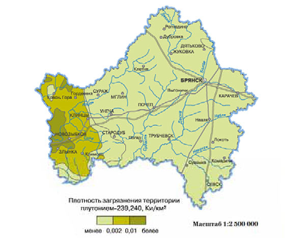
Map of contamination of the Bryansk region with plutonium 239, 240
Maps of Russian 137 Cs contamination of Chernobyl origin
Maps of 137 Cs pollution in the Bryansk region
The Bryansk region is the most unfavorable in terms of radiation. The western regions of the region will be contaminated with cesium radioisotopes for a long time. According to forecast estimates in 2016, in the area of the settlements of Novozybkov and Zlynka, the levels of surface contamination of cesium-137 will reach 40 Curies per square kilometer.

Map of contamination of the Bryansk region with cesium-137 (as of 1986)

Map of contamination of the Bryansk region with cesium-137 (as of 1996)

Map of pollution in the Bryansk region (as of 2006)

Map of predicted pollution of the Bryansk region (as of 2016)

Map of forecast pollution of the Bryansk region (as of 2026)

Map of predicted pollution of the Bryansk region in 2056.
Maps of 137 Cs pollution in the Oryol region

1986

Map of cesium-137 contamination of the Oryol region in 1996 year.

Map of cesium-137 contamination of the Oryol region in 2006 year.

2016 year.

Map of predicted cesium-137 contamination of the Oryol region in 2026 year.

Map of predicted cesium-137 contamination of the Oryol region in 2056 year.
Maps of 137 Cs pollution in the Tula region

1986 year

Map of cesium-137 contamination of the Tula region in 1996 year

Map of cesium-137 contamination of the Tula region in 2006 year

Map of predicted cesium-137 contamination of the Tula region in 2016 year

2026 year

Forecast map of cesium-137 contamination of the Tula region in 2056 year
Maps of 137 Cs pollution in the Kaluga region

Map of 137Cs pollution in the Kaluga region in 1986

Map of 137Cs pollution in the Kaluga region in 1996

Map of 137Cs pollution in the Kaluga region in 2006

2016 year

Map of predicted 137Cs pollution in the Kaluga region 2026 year

Map of predicted 137Cs pollution in the Kaluga region 2056 year
The material was prepared on the basis of the Atlas of modern and forecast aspects of the consequences of the accident at the Chernobyl nuclear power plant in the affected territories of Russia and Belarus, edited by academician Russian Academy Sciences Yu.A.Izrael and Academician of the National Academy of Sciences of Belarus I.M. Bogdevich. year 2009.